19° 55.69' S 133° 57.19' E
Expedition July 2009

| I've
been lucky to be
visiting Australia a number of times over the past few years, and I've
been making it a mission to try and visit the impact craters that are
relatively visitable and near my planned routes. Hodge's Meteorite
Craters and Impact Structures of the Earth, papers by
Shoemaker, the Earth Impact Database, and Google
Earth have helped fuel the search. I had passed through Tennant Creek before, but, until I re-read Hodge's book (after getting home), I hadn't realized how "close" the crater was supposed to be. (Hodge wrote it was 10km south of Tennant Creek, near the Stuart Highway - Not Quite!!!) This time, I determined, I'd do the research right, and try and get there. Unlike a number of other Australian Impact craters I'd visited, Kelly West was not well known. Hodge got me in the vicinity, then Google Earth nailed it down. It even looked as if there was a navigable road close by, if not all the way! But now the challenge. How to get there? Who owned the land? Who did I have to get permission from to go there? and Could our car get there? So, Back to the net. Australia has a great system of Visitor Information Centres, so I contacted the Tennant Creek Vistor Information Centre. (www.barklytourism.com.au) and had some great information back and forth (Thanks Roddy Calvert and Elliot - [email protected] ) At first, it appeared that the crater might be on Aboriginal Land / but it might be on Pastoral Land. See the first map below! Roddy connected me with Joe Firinu of the Central Land Council (CLC) to help determine whose land it was on. He looked at the map and suggested that it was partly on Pastoral land and partly on Aboriginal Land, and suggested that I apply for a permit. Land tenure in Australia is complex - In the last few decades, the indigenous people of Australia have been getting their land back... And for various reasons, some land requires a permit to cross or visit - some roads, even if it crosses aboriginal land does not require a permit, (if you stay on the road). So - I pursued both actions... Ms Calvert sent me the phone number of the Tennant Creek Station and I phoned them for permission for their part of the land. And the Central Land Council has an online permit process, so I applied, and expanded my request with an e-mail. Kathryn Cochrane responded with the comment that "Kelly West Crater is on pastoral lease therefore no permits are required." So, I was home free with permission. (OK, I compressed the phone calls to Tennant Creek Station - I called them from home, and then, as requested, called them when I was actually a lot closer, and knew a bit more) The last piece of the puzzle was to find out if there were any 4wd vehicles in Tennant Creek, or someone who had one... Thrifty Car Rental C/O Safari Lodge Motel, 12 Davidson Street, Tennant Creek, Northern Territory Does have 4wd on their list, but it gets booked up WAY in advance, I suspect by mineral exploration groups. And Elliot, at Tennant Creek VIC, came up with someone in Tennant Creek who would be able to drive and guide. I elected to go it on my own in our trusty vehicle..... continued
below
|
 or on Pastoral Land (permission required)")
If I had found this set of maps, it would have been a bit easier!!!
It is easy to see that the crater is on pastoral land (of course, the map above, and this map below don't quite mesh in their information...
")
Finally, it became time to plan the actual visit:
Planning Map
")
This is the joining of two Google Earth images showing the road from the highway to a parking area and subsequent approximate walking direction.
The imagery was taken in 2003, and the apparent "roads" (4wd tracks) going NW to the crater have grown over as of 2009.
While hiking, I saw an indication that someone had driven that way in the not too distant past - but it certainly was not a proper track!
Just after the Kelly Creek sign on the highway:
 |
 behind you - watch for cattle, termite mounds, big bumps, and various rocks") |
| Heading south from Tennant Creek, about 30 km from the
train station, and just before the highway does a noticible jog... Images from Google
Earth - Street View
|
That's it - the "road" west. The first gate is visible. Be a good visitor and always leave gates the way you found them. (on this road - most likely closed) |
| Finally came the day - leaving a bunch of stuff at the El Dorado in
Tennant Creek (including my sweetheart, who wasn't interested in the
hike) - I headed south from town... Again, Google Earth was my friend.... 30.3 km south of the Tennant Creek Train Station (which is several km south of town), just before the the highway does a jog, there is an unmarked turnoff. (image above) I made the turn, opened the first gate, drove through, closed the first gate and was off on the dirt road. It's a pastoral station, so I was expecting cattle, however, only evidence of bovines was on the road. A few km in, and I got to the second gate. This one keeps the cattle off the train train tracks. The Darwin to Adelaide line passes by here, and it was stop, open gate, drive, stop, close gate, drive to tracks, look both ways, drive to next gate, stop, open gate, drive, stop, close gate.... and then on... It was a basic single lane dirt outback track. Occasional small termite mounds, some sand, some gravel, some plants in the middle... I occasionally had to get out of the ruts so I wasn't scraping bottom. A couple of interesting Bumps! Looks like someone buried a pipeline, or plowed up a water break... About 26km later, I found the place to begin the walk... 19° 59.25'
S 133° 59.32
I marked the site on the GPS, grabbed lots of water (5 liters), some food, cameras, coat.... and headed out. |

This is part of the walk - some gibber like surface, but lots of scrub - The bad news, Spinifex and Speargrass
Spinefex has sharp spines - stepping on top of it, sometimes results in less punctures. Good Strong Gaiters are reccommended
Speargrass is a bit more insidious... poking its spikes into yourr pants, socks, shoes, and then gouging into you...
The 7.x km walk was certainly not that... veering left and right to avoid the real ouchy bits, and thicker scrub - maybe 10km each way...
The crater area is the slight bulge on the horizon on the left half of the image.
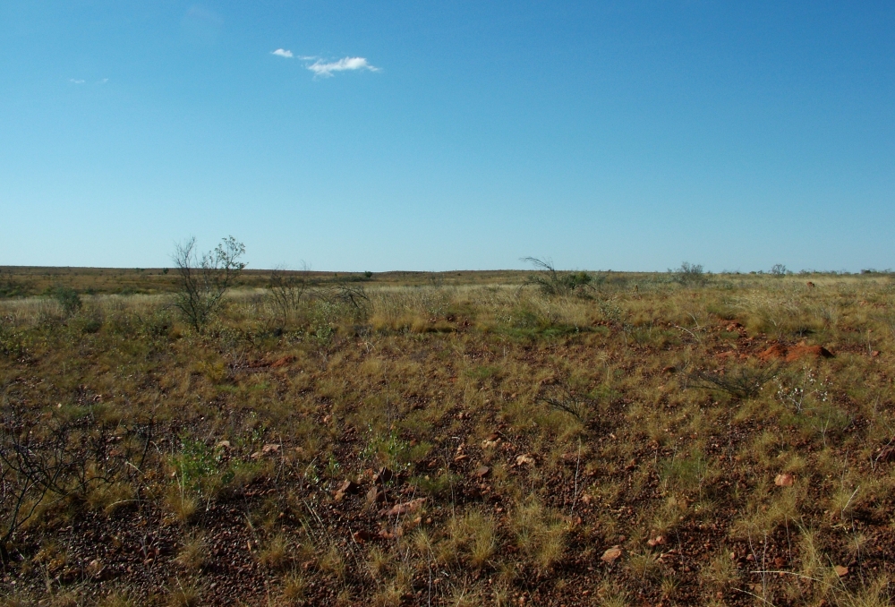
The vegetation changed as I got closer to the crater area, not as much spinifex - but a few more rocks and elevation changes.
The red-brown mound to the right is a termite mound.
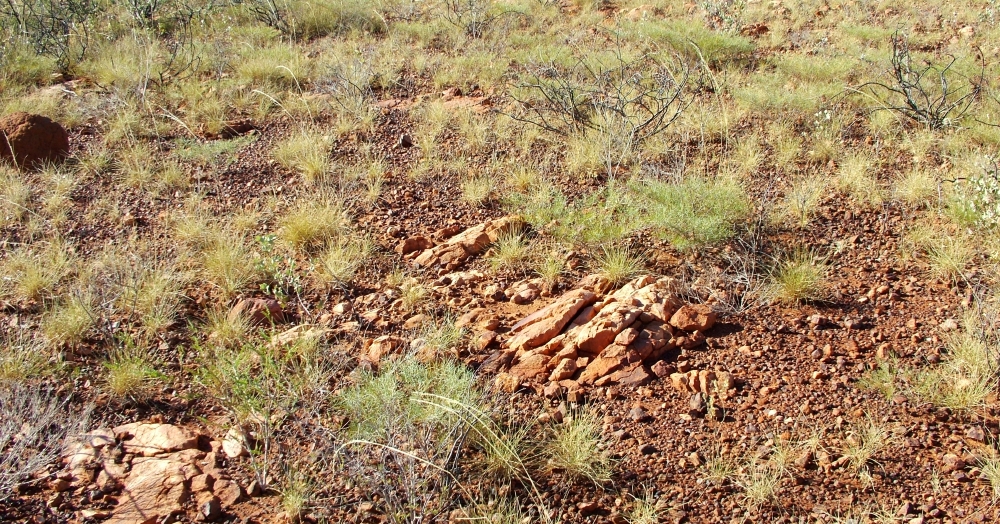
If the GPS hadn't given me the hint, the change in orientation of the rocks tipped me off.
This batch of tilted rock appeared to be on the crater rim....
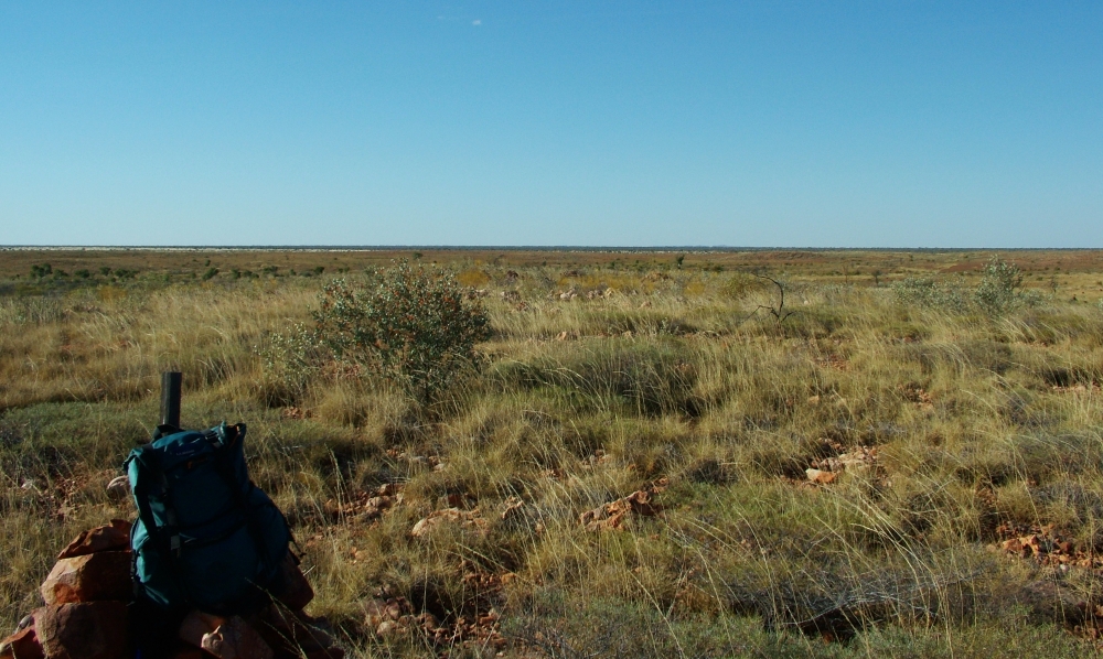
Another termite mound on the left
The image below was taken from close to this point.
This is a panorama of the Kelly West crater from the SE rim and centered on the central uplift. It includes the rim to each side.
Yes, it's a little subtle in this image - easier to see in person... I'm on the "rim" looking into a depression, where a stream bed is on this side, and it rises to the central uplift.
The "rim" goes around about 3/4 of the central uplift.
The left side is looking SW and the right side is to the North.

Finally, the summit...
I arrived pretty close to my "turn-back" time (drat), about 2 hours after setting out. Well, enough time to take some pictures, look at some rocks, and head back.
Someone had put up a cairn with a pole in the middle, and it did appear to be the highest point in the area. Apparently, some older maps list it as Mt Kelly West.
 degree panorama from the center of the central uplift of Kelly West Crater")
This panorama is from the summit of the central uplift of Kelly West Crater - Left side is about NW - middle is SE (7+km that way is the car!) - right is W
It's not a full 360 as the sun was blowing out the imagery to the final segment - (about 4pm, sunset at ~6pm)
At the summit - drink some water and start a walk around. This is looking roughly north towards some interesting rocks.
Some of the rocks at the center - apppears to be some shock effects...
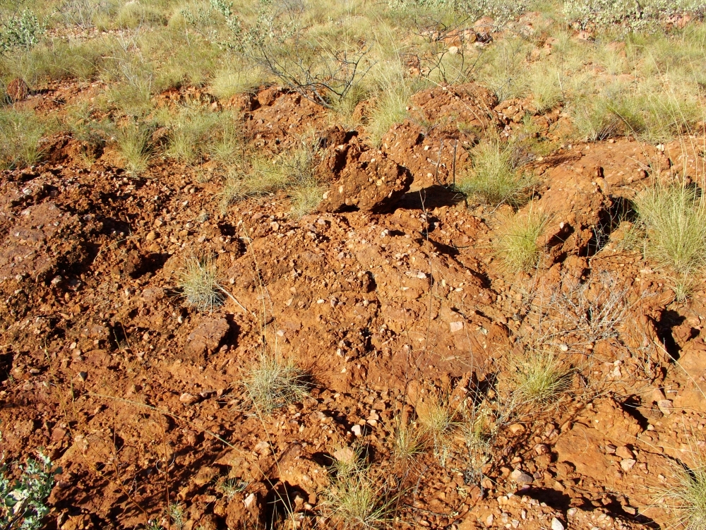
To the west side of the top, this batch of material - the brown is not dirt, it is rock, with the light fragments embedded.
This may have been laid down after the impact.
Kelly West Rocks
Click to see the larger version
| Shattercone from the central uplift summmit | 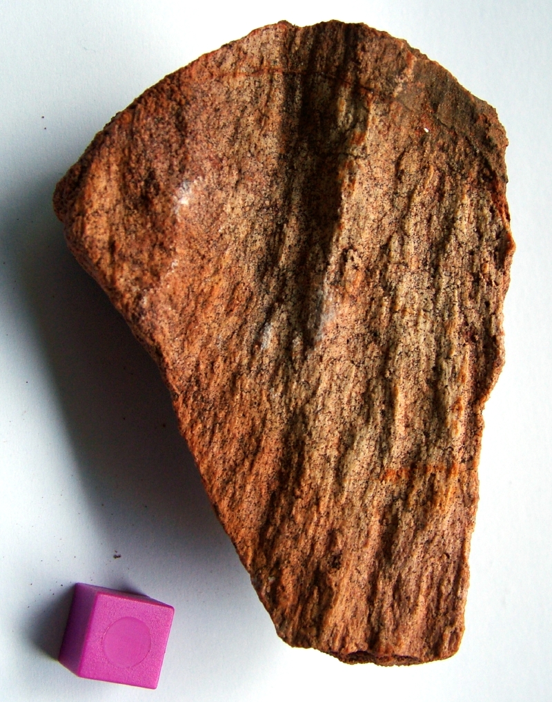 |
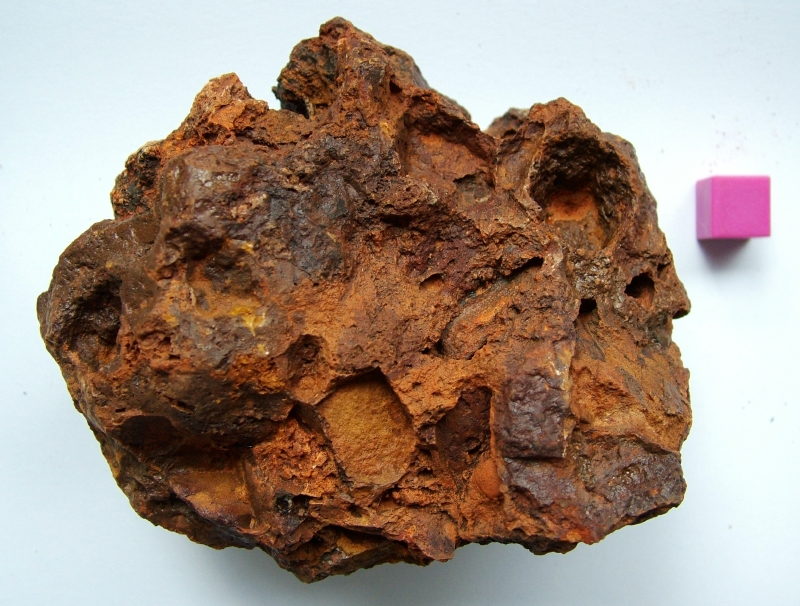 |
Found about 4-5 km from the central uplift - possible
impactite/breccia??? Needs investigation (to be started soon) |
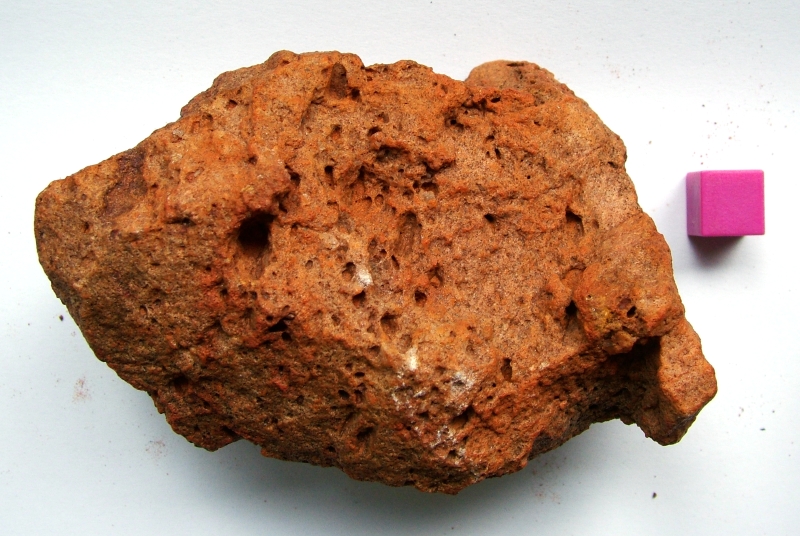 |
Found about 4-5 km from the central uplift - possible
impactite??? Needs investigation (to be started soon) |
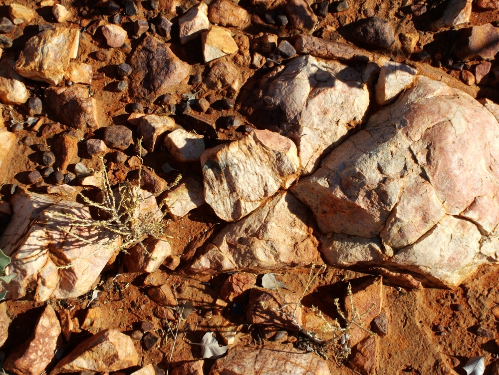
| Non-crater related gibber / country rock | 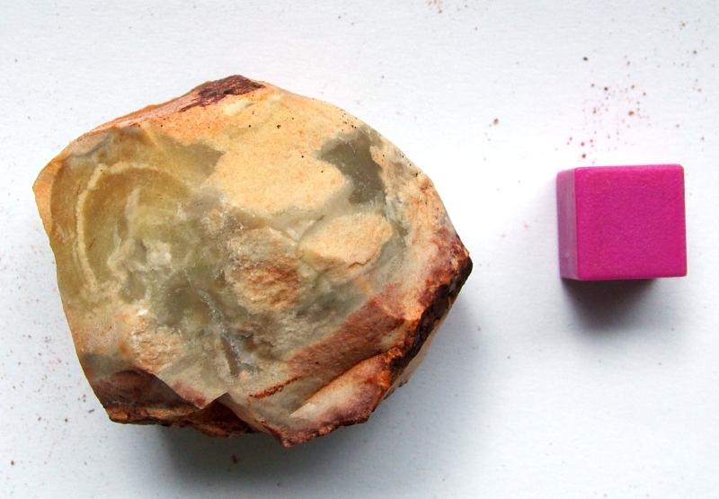 |
Science Questions...
Hodge and the Earth Impact Database both report that the impact is >550 MY old, and that the crater is 10km in diameter. However, unless there is some data I haven't seen (quite possibly, I do need to review the literature!), the structure that is visible is on the order of 2 to 3 km in diameter. Granted, it's highly eroded, which means that the visible structure might be just aspects of the original central uplift.
But, look at Google Earth, and look at the image based on one of the EID images. It's hard to find evidence for a 10km crater. Perhaps there is a gravity survey somewhere...
Last Notes:
| Having taken 2 and a bit hours to get out to the site,
I
needed at least 2 hours to get back, that left me 20-30 minutes or so
at the crater. Not the optimum amount of time :-( so I had to look
around fast, and I know a lot for next time :-) Interesting batch of rocks - clearly a highly eroded old crater, yet the basics were there. Along the way, I picked up a few interesting rocks that were different from the norm - and I suspect they might be impact breccias - (to be investigated) and a hint of shatter coning at the central uplift. (that's one reason I'd have liked to have more time there - to look over more of the uplift rocks.... as well as the ones on the rim) [ahhhhh next time] Want to repeat my trip? Send an e-mail and I'll get you some additional information... and, I strongly suggest you do it in the southern winter (northern summer) as it is a lot cooler then. Be prepared! (snakes, spiders, spinifex, speargrass, dehydration, cattle, and all the other joys of an outback/centre hike) |
Timeline of visit
| Left Tennant Creek | 12:45 pm |
| Parked ~67km from TC by road | 1:45 pm - left the car 12 minutes later |
| Arrived at site | 4:10 pm |
| Left site | 4:30-ish pm |
| Sunset | 6:00 pm |
| Arrived at Car / Starting to get dark | 6:29 pm |
| Dark | 6:45 pm |
| Back at Tennant Creek Beautiful dark skies, no moon, and I had to go slower on the 26km dirt stretch back to the main road. |
8:00 pm |
Page by Ted Brattstrom -
updated 6-Sept-2009