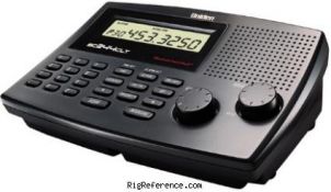
Uniden / Bearcat
BC244CLT Scanner
modified for wide
bandwidth
by SSC
(Software Systems Consulting)
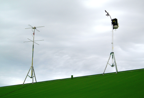
Crossed Yagi,
Circular Polarized Antenna (on the left)
Ka'u Science Weather Station on the right
Ka'u Science Weather Station on the right
Computer system with
Sound Card input
(cleaner) signals from lower to the horizon )
(also, new portable system for demonstrations
Thanks again Lucas and NOAA)
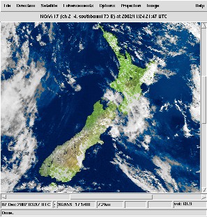 WXtoIMG (restored) Software
Takes audio from the sound card, turns it into an image,
enhances and adds borders and lat/long lines!
enhances and adds borders and lat/long lines!
One issue that plagues computers - Time
This was a problem on the Win2000 machine running the station
- if it is a problem for you. May I suggest:
This was a problem on the Win2000 machine running the station
- if it is a problem for you. May I suggest:
I've been using it now for the past several months, and it has near
eliminated the problem of offsets of the map and real islands.
Free for private, educational and charitable use.
eliminated the problem of offsets of the map and real islands.
Free for private, educational and charitable use.